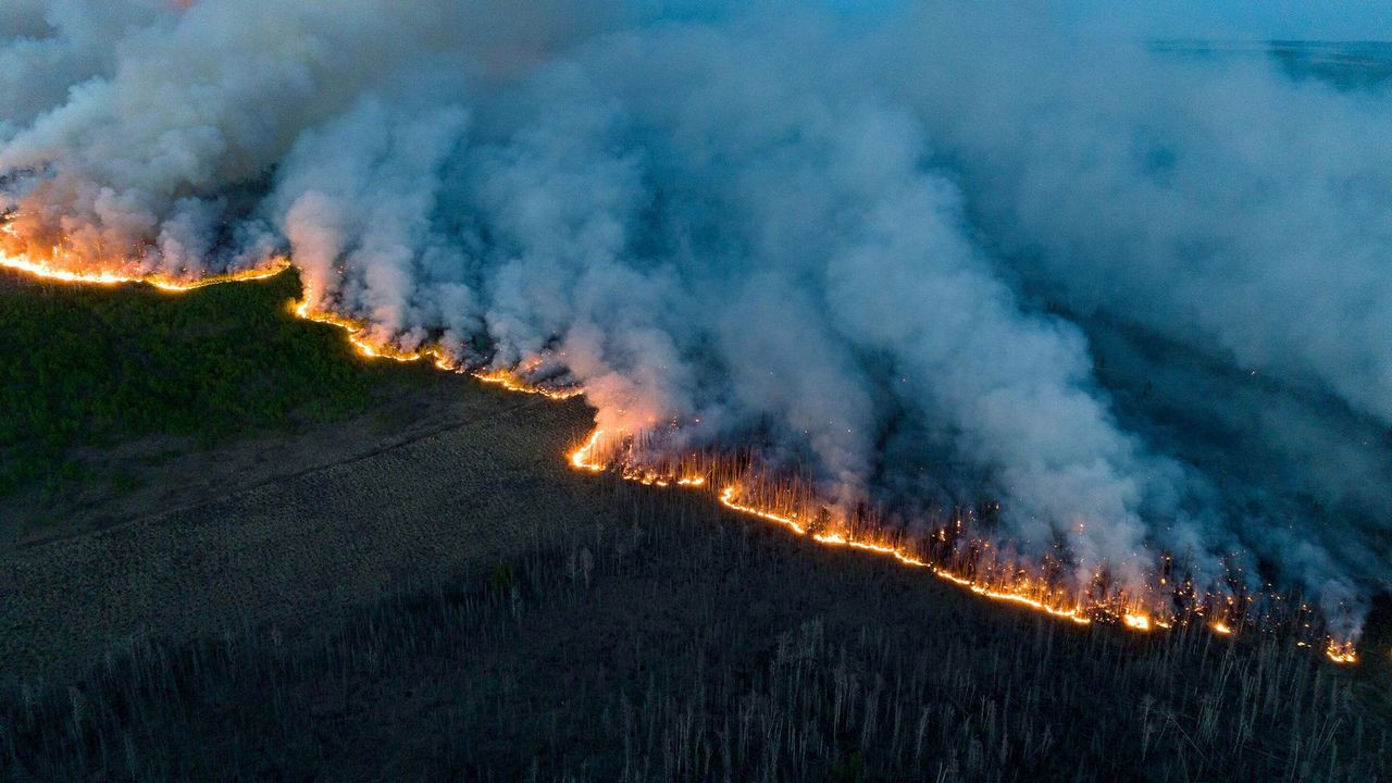
Wildfire Solution
OroraTech offers the first global wildfire intelligence solution, including risk assessment, early detection, real-time monitoring, and damage analysis with data from 20+ satellites.
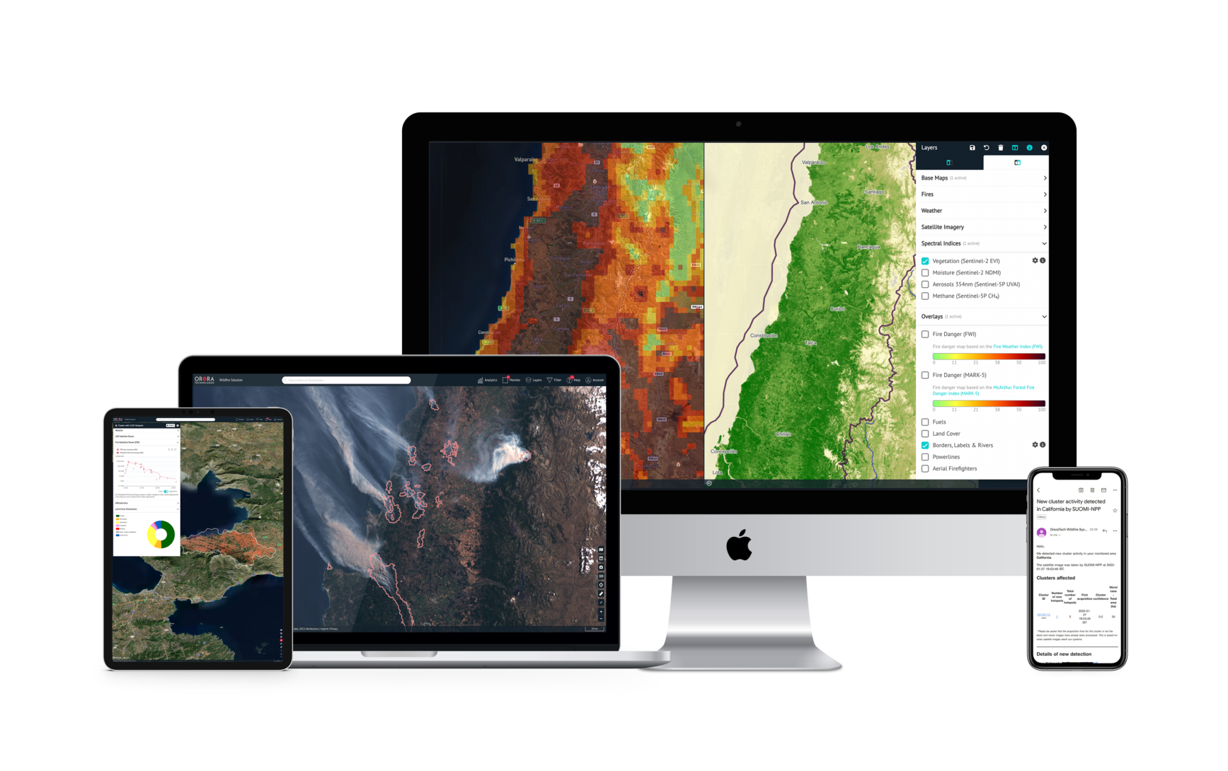
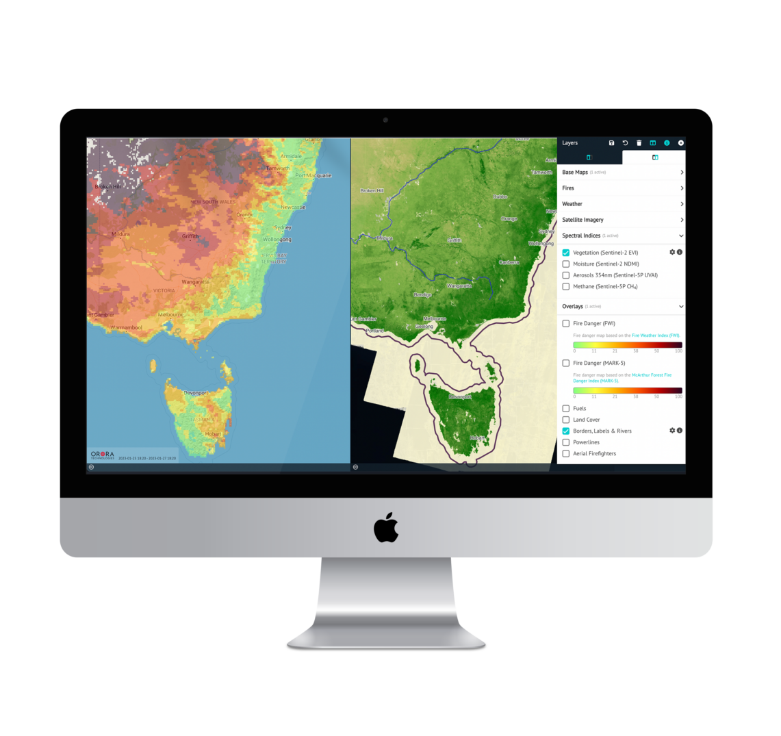
 FIRE DANGER INDEX
9-day forecast and mapping of the fire risk in your area.
 WEATHER Information
Including wind speed & direction, temperature, humidity and more.
 LIGHTNING STRIKE
Real-time lightning strike data with exact location and time of occurrence.
 VEGETATION & TERRAIN
Land cover and fuel maps help analyze the terrainĺs condition.
20+ SATELLITES Ensuring precise 24/7 detection with several updates per hour.
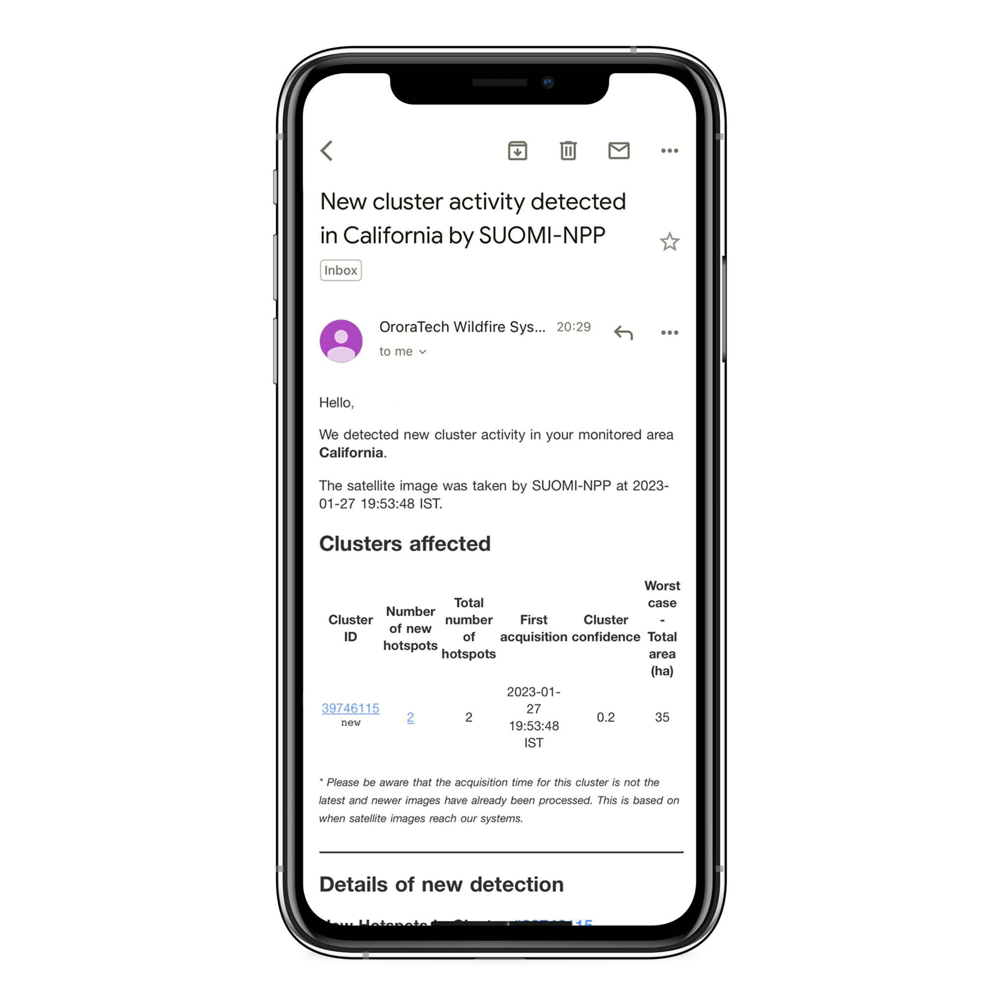
AUTOMATIC NOTIFICATIONS
Get instant Email, WhatsApp, SMS or In-App alerts for any new detections in your monitored areas.
CUSTOMER DATA INTEGRATION
See your own weather stations, cameras, and sensors.
LOCATION & FIRE SIZE
Receive (directly) the coordinates and affected area estimates.
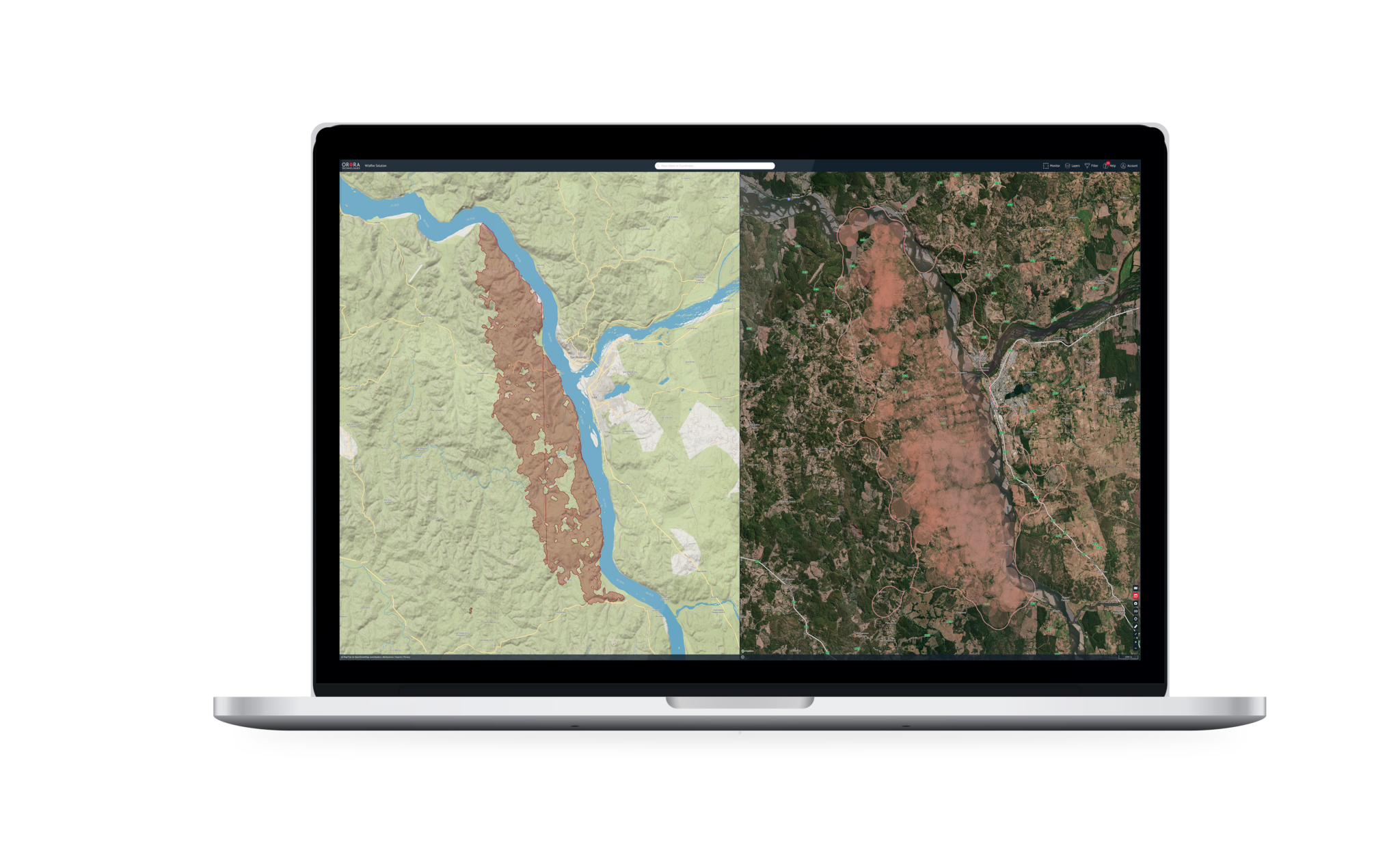 LIVE FIRE TRACKING
Near-real time monitoring to track the fire area and development.
ACTIVITY FEED
One overview for monitoring all active fires in your risk areas
Including wind speed & direction, temperature, humidity and more.
FIRE PROPAGATION
Estimate the possible fire spread based on different information sources.
INCIDENT MANAGEMENT
Coordinate actions for wildfire management and combat.
FIRE ORIGIN & EVOLUTION Detailed analysis from fire start to end.
BURNT AREA
High-resolution mapping of burnt areas and fire severity calculation.
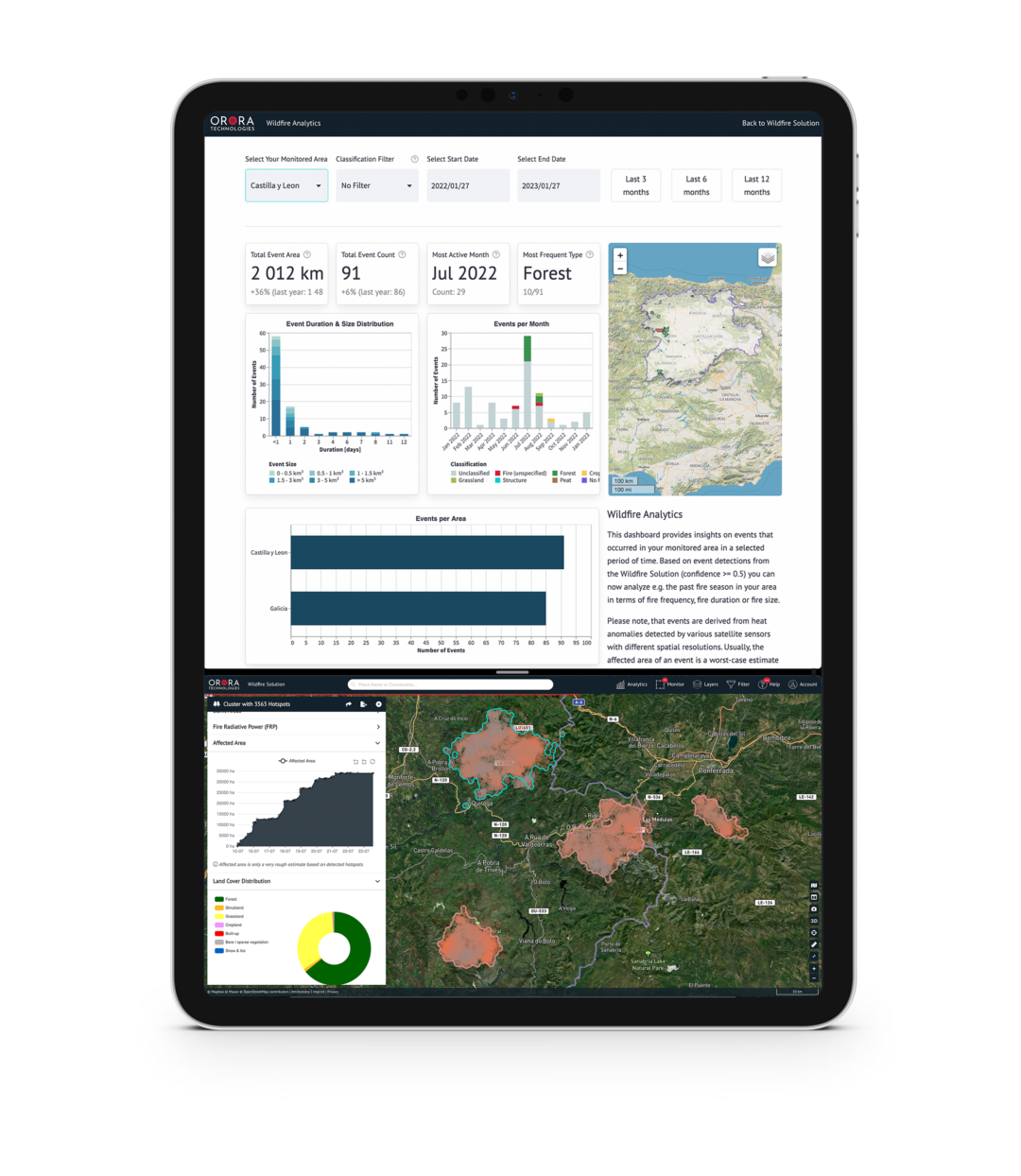
LONG-TERM FIRE STATISTICS
Export historical fire data and analytics.
Export historical fire data and analytics.
FIRE FILTERING
Analyse events based on automated and manual classifications of type and cause.
Responsibiliity
FROM DETECTING THE FIRST BLAZE TO NOTIFYING YOU
From raw data to real wildfire intelligence.
We ingest data from various satellite data providers and operate an additional satellite groundstation (EUMETCast).
Data types and formats between data sources are unified which enables common handling of data in future processing steps.
High temperature sources are detected with multiple different and parallel algorithms.
Hotspots are correlated with environmental data followed by static and dynamic rejection of hotspots.
Algorithms identify coherent fire pixels and aggregate spatio-temporal hotspots for fire tracking.